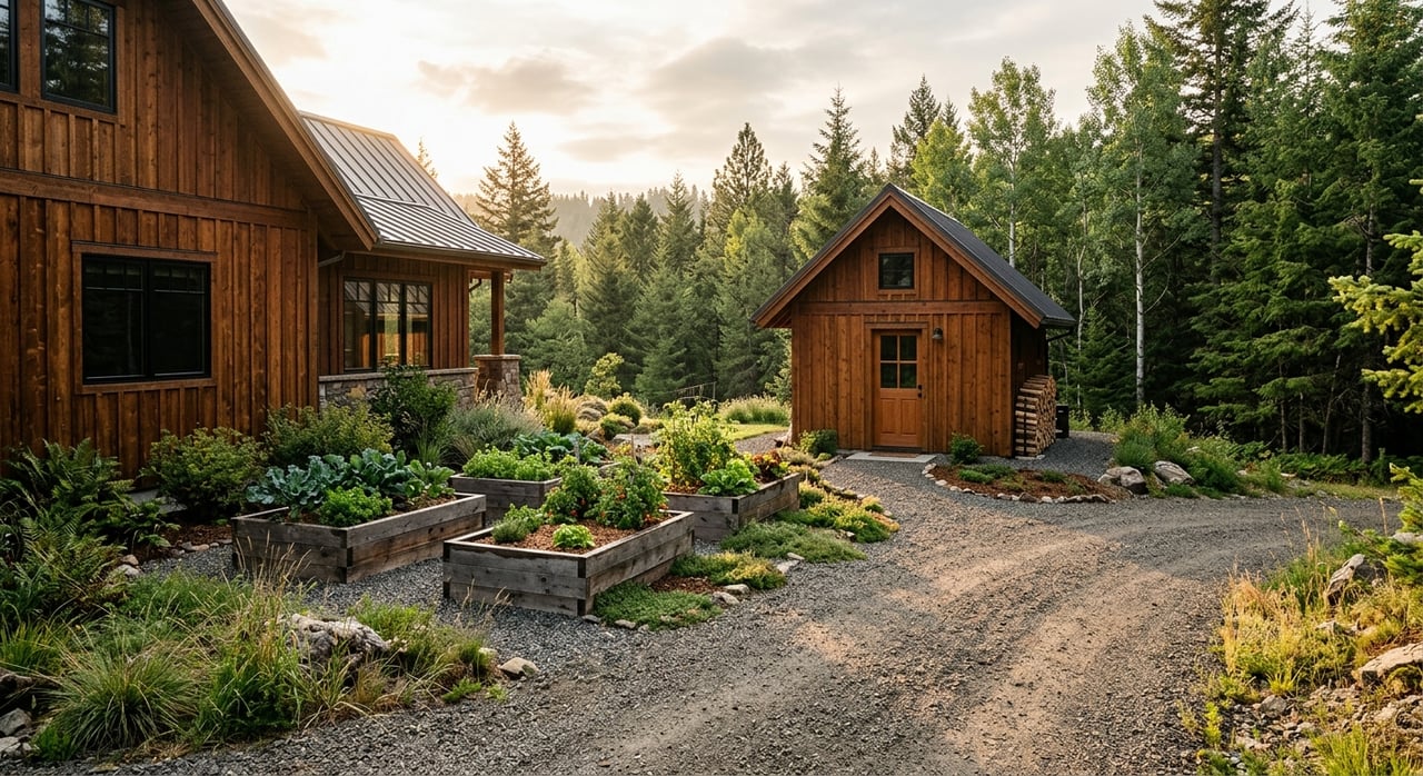
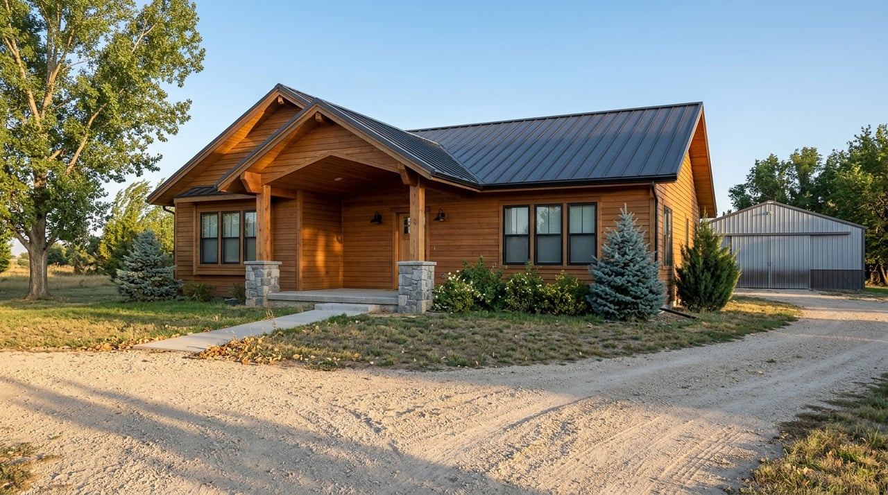
Shopping for a Missouri River property near Cascade and seeing the words river frontage and river access used interchangeably? Those two phrases can mean very different rights, responsibilities, and day-to-day experiences on the water. If you fish, float, or just want an easy place to launch, the details matter. In this guide, you’ll learn what each term actually means in Montana, how it affects recreation and value near Cascade, and which steps confirm what a listing truly delivers. Let’s dive in.
River frontage vs access: plain-English definitions
Understanding a few core terms will help you compare properties with confidence.
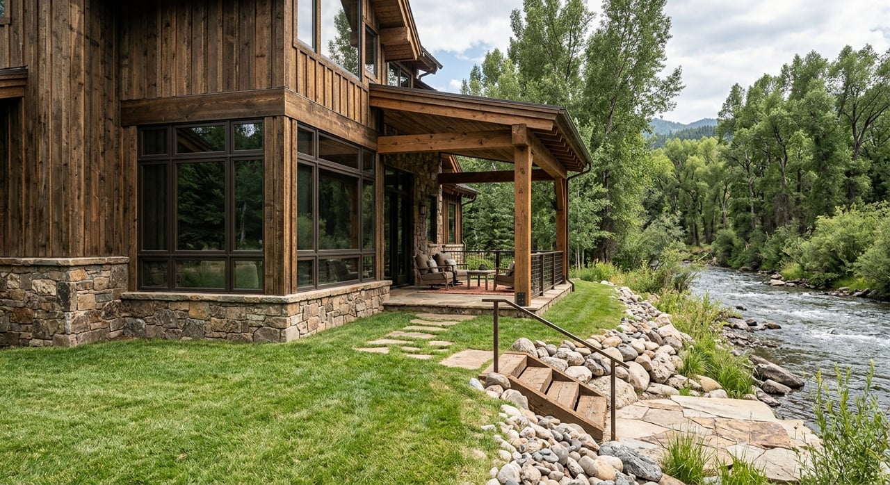
- River frontage: Your property line meets the high-water edge of the river. You can physically walk from your land to the water. This does not automatically include rights to divert water.
- Deeded access: A recorded right in your deed that lets you reach the river through a specific strip or easement. It can be exclusive to you or shared with other owners.
- Common-area or HOA access: Access held by an association and governed by rules, fees, parking limits, and maintenance obligations.
- Public access: A county, state, or federal site open to everyone. It can be close to a property but is not part of your private ownership.
- Easement: A recorded right to use another’s land for a specific purpose, such as a footpath or ramp. Easements run with the land and should show on title or a plat.
- Ordinary high-water mark (OHWM): The legal boundary that often separates private land from state-owned riverbed. A survey helps determine where your property ends.
- Water rights: Separate from land ownership in Montana. To divert or use water, you generally need a separate water right or authorization.
Key takeaway: owning land to the waterline is different from owning water-use rights. Always verify title, survey, and any water-right records before you assume what you can do on or with the river.
What matters near Cascade on the Missouri
The Missouri River around Cascade includes both reservoir shoreline and flowing river reaches. Upstream impoundments like Holter Reservoir behave differently than the tailwater stretches below dams. Shorelines, boat use, and species can vary by reach.
Public infrastructure is significant along this corridor. Various agencies maintain boat launches, fishing access sites, campgrounds, and day-use areas. These public options can be valuable if a property does not have private frontage.
When you evaluate a listing near Cascade, confirm the following:
- Exact location relative to dams and reservoirs. Reservoir shorelines and tailwaters perform differently for access and recreation.
- Which entity manages the nearest public facilities. Rules, parking, and fees vary by manager.
- Whether the listing offers frontage to the shoreline or to the OHWM. Ask for a recent survey.
- Whether public land or a county right-of-way sits between the parcel and the water. That can change practical access.
How access type shapes your lifestyle
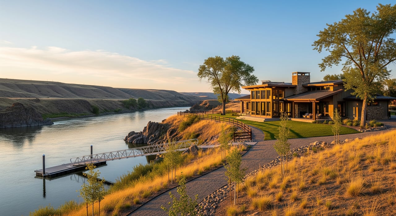
Private river frontage: pros and tradeoffs
- Pros: Direct walk-out access to the bank or water. You can fish from your property and stage gear without leaving home. Privacy is a major draw.
- Cons: Banks can be steep, rocky, or brushy. You are typically responsible for maintenance and any permitted work. Liability and insurance needs can be higher, especially with docks or ramps.
Deeded or HOA access: pros and tradeoffs
- Pros: Lower purchase cost than full frontage, but you still get a convenient path to the river. Maintenance is often shared. Rules can help manage parking and use.
- Cons: Shared access can mean busier use during peak seasons. HOA rules, fees, or trailer limits may apply. The width and condition of the access strip affects how easily you can launch.
Relying on nearby public launches
- Pros: Robust parking, ramps, and amenities. Often free or low cost. Maintenance is handled by the managing agency.
- Cons: Sites can be busy at prime times. You may need to drive from the property. You might not be able to leave trailers or gear unattended overnight.
Fishing and boating checks
Species and seasons
Tailwater sections below dams often stay colder and can support trout fisheries such as rainbow and brown trout, depending on releases. Reservoir stretches commonly host warm-water species like smallmouth bass, walleye, perch, and pike, depending on the specific reservoir. Seasonal changes matter for both species and access, from spring flows to ice conditions.
Boat size, motors, and parking
Reservoirs usually allow larger boats. Some river sections are shallow or snaggy, which favors drift boats, rafts, and kayaks. Local rules can limit motor size in specific areas. If you plan to launch a drift boat or trailered motorboat from a deeded strip, confirm the access width, grade, surface, and parking space.
Float-trip logistics
If you want to float different reaches, map put-in and take-out points and the distances between them. Public sites create flexibility for one-way floats. Private frontage or a private take-out can add value if you prefer shorter or custom float lengths.
Risks, permits, and insurance to budget for
Erosion, flooding, and floodplains
Riverbank erosion and slope instability are common near moving water. Many waterfront parcels sit in FEMA-designated flood zones. That can trigger flood insurance requirements, elevation standards, and building setbacks. Ask about historical high water and any stabilization work already completed.
Work that needs permits
Docks, piers, ramps, shoreline armoring, and dredging often require permits. You may need approvals involving federal, state, and county agencies depending on the project and location. Requirements can differ between reservoir shorelines and flowing river reaches.
Liability and maintenance
Private docks and launches increase liability exposure. Insurance, signage, and safe design help manage risk. Shared access can raise enforcement and maintenance questions, so review who pays for upkeep, how rules are enforced, and where guests can park.
How access influences value and resale
- Private, exclusive frontage tends to command a premium for convenience and privacy, especially where continuous frontage is scarce.
- Deeded but shared access usually sells at a discount to private frontage, but at a premium over properties that require a drive to public sites.
- Properties near strong public access points often attract buyers who want convenience without shoreline maintenance, though the premium is typically lower than private frontage.
- Costs such as HOA assessments, bank stabilization, or permits can offset part of the premium.
- Short-term rental potential can improve with either private frontage or proximity to quality access, but local zoning, HOA rules, parking, and access clarity drive real outcomes.
- Appraisals consider access type, flood exposure, and usable shoreline. Ambiguous access language tends to reduce appraised value relative to marketing claims.
Your due diligence game plan
Request and review the right documents:
- Deed, plat, and any recorder’s notes showing easements or reservations.
- Current title report and policy exceptions related to access.
- Recent boundary survey showing the OHWM, property lines, access strips, and setbacks.
- HOA or POA covenants, rules, and meeting minutes covering access and maintenance.
- Records of past permits for docks, ramps, or bank work, along with correspondence about approvals.
Walk the ground and verify conditions:
- Walk the route from the home site to the water. Confirm grade, surface, and parking for vehicles or trailers.
- Identify the high-water mark and ask about seasonal water-level changes and historic events.
- Check FEMA flood maps and county floodplain layers to understand insurance and building constraints.
- Ask about prior stabilization, riprap, or erosion control measures. Request permits and invoices.
- Confirm septic and well setbacks relative to the OHWM through county health rules.
Know your local contacts and where to ask questions:
- Cascade County Clerk & Recorder for deeds and plats.
- Cascade County Planning & Zoning for setbacks, floodplain, and permits.
- Montana Department of Natural Resources & Conservation for water rights and shoreline work that may need state authorization.
- U.S. Army Corps of Engineers if the area involves a reservoir or federal project lands.
- Montana Fish, Wildlife & Parks for public access sites, fisheries reports, and seasonal regulations.
- The local conservation district or extension office for best practices on bank stabilization.
- A local real estate attorney and licensed surveyor to interpret deeds, easements, and surveys.
Smart offers and negotiations
- Make your offer contingent on confirming frontage or access via title and survey.
- Require sellers to provide proof of permitted shoreline improvements or to address unpermitted work.
- Consider escrow holdbacks for unresolved easement questions or title exceptions.
- Clearly allocate who is responsible for any permits or corrections discovered during due diligence.
Which option fits your goals?
- Choose private frontage if you want maximum privacy, direct bank fishing, and the ability to stage boats and gear at home. Budget for erosion, flood insurance, and potential permits.
- Choose deeded or HOA access if you want a more affordable price point with convenient river reach, and you do not need a private dock. Review rules for parking, guests, and maintenance.
- Choose proximity to public sites if you value low maintenance and easy driving access to multiple launches. Expect more seasonal activity at nearby public ramps.
If you want help reading a survey, confirming access language, and building a smart offer, our team is here to guide you from first showing to close.
Ready to compare specific properties near Cascade and verify what the listings really promise? Connect with Lynn Kenyon to align your wish list with the right river access and a clear due diligence plan.
FAQs
What does “river frontage” mean in Cascade listings?
- It usually means your property touches the river at the high-water edge, but that does not guarantee exclusive use or ownership to the OHWM. Verify with the deed, survey, and title.
Do you own the water or get water rights if your land touches the Missouri?
- No. Water use follows Montana’s water-rights system, which is separate from land title. Diversions typically require a water right or authorization from the state.
How do shared river access easements work near Cascade?
- Your rights come from recorded documents, not verbal assurances. Review the easement language or HOA rules to understand scope, parking, and maintenance.
Are docks or bank stabilization always allowed on the Missouri River?
- No. Many shoreline projects need permits that may involve federal, state, and county agencies, and requirements can differ by reservoir versus flowing river sections.
Will a lender require flood insurance for a river property?
- Often, if any structure lies in a FEMA flood zone. Waterfront locations increase the chance that flood insurance and elevation standards apply.
Who manages public fishing access sites and boat ramps around Cascade?
- Management commonly falls to Montana Fish, Wildlife & Parks, the county, or the U.S. Army Corps of Engineers. Those agencies set and enforce rules, fees, and parking.